
Yak-shemash and welcome to this high-altitude update on Nepal. I am writing to you from our hotel in Kathmandu, where Judith and I sit, take turns drinking Masala tea or beer, and wait for our flight to Thailand (the last stop on our journey – aaaaaaaah!). Since I have a lot of time to spare, and since we've spent quite some time in Nepal, this post will be... the longest post yet! Muahahaha! There's no way to escape. Since this post is so incredibly long, here's a table of contents:
- busy Kathmandu
- trekking in the Himalayas - one of the highlights on our tour to date
- the lakeside town of Pokhara
- exciting safaris - including a real safari documentary video, yeah!
- how to kill time in Nepal - e.g. by writing long blog posts
- random observations about the country and its people

Chapter 1: We started off in the capital of Nepal, Kathmandu, taking care of some logistics (such as buying trekking equipment, getting permits, or arranging transport). Despite its nice location in a fertile valley and its altitude of 1,300 meters, Kathmandu is not exactly a beauty. Most tourists try to escape the traffic and the smell as quickly as possible. I'm not an English native speaker, but I believe the technical term for a place like this is 'shithole'. Apologies to all of our readers from Nepal, it must be the lack of oxygen talking.

Our accommodation in Kathmandu was close to Thamel, the local tourist trap. The Thamel quarter is the proud home of hundreds of fake North Face shops geared towards the needs of the Western outdoors tourist. Besides indulging in buying fake stuff, we had a great time observing the many 'Jesus-tourists' in town. Jesus-tourists differ from regular tourists in their physical appearance and in that they typically are in search of spirituality, themselves, or new chemical substances. In terms of appearance, both the clothing and the tendency to grow facial hair make them resemble the man who, 2000 years after his death, still has a stronger influence on Italian daily life than Mr Berlusconi - hence the name. But judge for yourself, here are some pictures.


Anyway, our main reason to visit Nepal was to go trekking in the Himalayas, not to take pictures of fellow tourists. Having considered several trekking regions in Nepal, we eventually opted for the well-known Annapurna Conservation Area. Some 6-7 hours (bus or walking, same same) West of Kathmandu, Annapurna offers a range of treks, among them the 2-3 week trek around the entire Annapurna mountain range – the Annapurna Circuit. The Circuit passes by (not over) several 8,000-metre-peaks and a variety of vegetation zones. We decided not to hire a guide or porters, but to go independently. I just needed the exercise to do something against my beer belly. Later, we estimated that some 75% of tourists we met on the trek did have a guide, or a porter (who can carry up to 45kg - incredible), or both. I can't blame them. Well, maybe a little. Below, you'll find a summary of our trekking experience. In case you are wondering why the pictures look different – we left our nice SLR camera at home, carrying a light-but-not-so-nice one instead. That's the price you pay for not hiring a porter.
Days 1-3: The green rice paddies
Highly motivated, but also unsure about what to expect, we started our trek on the Annapurna Circuit in the town of Besisahar at an altitude of only 800m above sea level. We used the first few hours of walking to get accustomed to our flashy new (and of course fake) Leki walking sticks and our backpacks. Judith carried around 13kg, I did 18kg.


Passing through beautiful rice paddies, we trekked at a good pace along a white-water river in a valley. The one thing slowing us down were several steep ascents, which we often had to tackle in the midday heat (yes, Nepal can get sub-tropical in places).


During the ascents, we cursed every kg in our backpacks, but on the flat parts of the trek we coped well with the weight. Usually, we started trekking rather early, getting up at around 5.30h. Yepp, travelling can be hard work. In return, we managed to arrive at our destination at around 1 – 2pm, which enabled us to wash some clothes, take (bucket) showers, and dry our stuff before going to bed at 6 or 7pm - no kidding. Without light, there's just not a lot you can do in the evening. In every village along the trek, there are several 'teahouses', offering very basic accommodation at very basic prices (we paid as little as € 0.5 for a 'room').
 The food on offer was a strange mix of Nepali, Indian, and Western dishes, but it did the trick. For most of the trek (and most of our time in Nepal in fact), we went for vegetarian, since the level of hygiene in handling meat in many parts of this country is as appetising as a dentist's job description. At the end of our first three days, after 45km of trekking, and with many beautiful impressions in our head, we arrived in Danaqyu (elevation 2,200m).
 Days 4-6: It's getting cold
In the days following Danaqyu, our trekking routine (getting up early, eating apple porridge, hiking, devouring more carbs, sleeping early) didn't change much, but the landscape did. Gone were the rice paddies, replaced by the pine-dominated mountain landscape you would expect at an altitude of around 3,000m.


 Fortunately, the Maoist rebels which had occupied the territory in the region until a few years ago didn't bother to bother us. Day 5 in particular was fabulous – I hope I won't forget the scenery for the rest of my life, or at least not until Alzheimer kicks in. For the first time ever, Judith & I saw an 8,000m peak (Mt. Manaslu) and several 7,000m peaks (e.g. Mt. Gangapurna, Annapurna III). Amazing. We spent the evening of day 5 and day 6 in the area around Manang (elevation 3,540m), gazing at the peaks and acclimatising to the altitude. Watching 'Into Thin Air', a movie about lots of people dying of Acute Mountain Sickness (AMS) at Mt. Everest, maybe wasn't the best idea, but Manang's movie theatre itself (a room with wooden benches, a fireplace, and complimentary hot tea) was definitely worth the experience. We also met some trekking buddies: Scott & Kris from Canada/ Hong Kong were great companions and their endless reservoir of Family Guy & Borat quotes made even the steepest ascents seem fun. I like. From a logistics standpoint, Judith & I managed to reduce the weight of our backpacks by almost 3kg each by eating our food stocks, reducing the amount of water we carried, and getting rid of some completely worn out clothes.
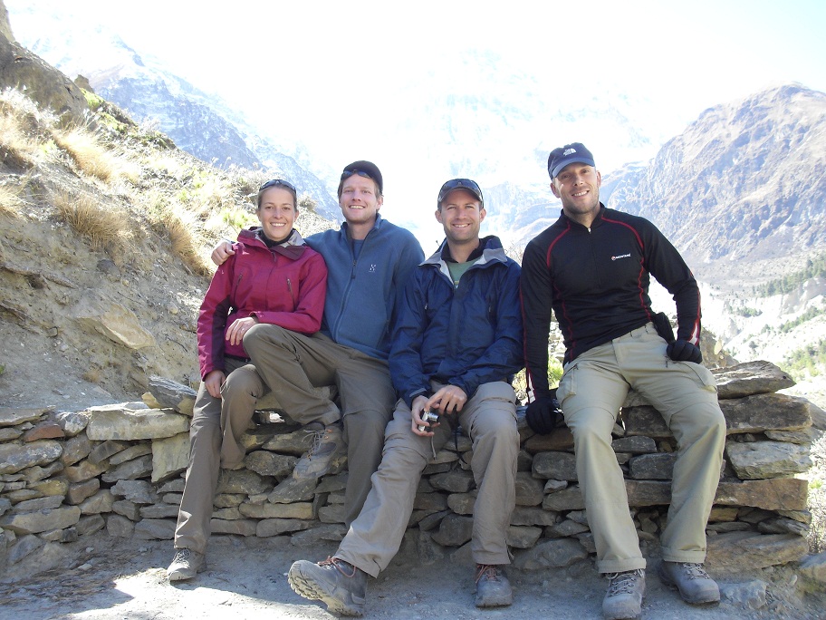

Days 7-9: Passing the pass
In terms of distance, day 7 and day 8 were shorter than the previous ones – a fact which was very much welcomed by Judith's back and my knees. Basically, at that altitude, you shouldn't go higher than 300m – 500m in altitude per day. Otherwise, your chances of getting AMS are too high – and that threat is very real. We talked to one guy who had spent his nights before sleepless, vomiting his guts out. Despite these classic AMS symptoms, he continued the trek with his group.

Well above the tree line, even the last shrubs started to disappear as we continued our way up. Our main worry by then, being at 4,200m – 4,500m, wasn't the vegetation, though. We were more concerned with breathing (there's only slightly more than half the oxygen you would get at sea level) and sleeping at -10°C room temperature at night (we checked!). Thankfully, our substantial investment in top-notch sleeping bags finally paid off. After all, we had carried them around the world for 8 months for this special occasion. Despite the challenges, the views and the overall experience were great.

Day 9 was the big day: crossing the Thorung La, which, at 5,416m, is one of the highest passes in the world (locals of course claim it to be the highest). We left our teahouse, the 'Base Camp', at 5am, slowly ascending the winding trail using our headlamps.
To climb the 1,000m took us some 3.5 hours, since we literally went step-by-step, taking several breaks on the way. Considering we were carrying our heavy backpacks, we still did it in a respectable time, overtaking many other tourists. Sometimes, we even overtook the main source of traffic, donkeys.


Once we reached the pass, we took a quick picture, peed (increased bladder activity is normal when adjusting to altitude), and tried to get down again as quickly as possible. Temperatures at the top were some lovely -20°C, not taking into account the heavy wind-chill.

On the way down, Judith virtually ran down the trek, leaving her male knee-handicapped trekking mates Scott, Kris, & myself in awe. After a total distance of 19km, 1000m up, and 1,600m down, we were relieved to finally arrive in our teahouse in the town of Muktinath. To celebrate, we got slightly drunk. Sadly, we later found out that not everybody managed to pass the pass as well as we did. Remember the guy with the AMS symptoms? Well, having arrived in his teahouse in Muktinath, he fainted, hit his head, and died. We were shocked when we heard the news.

Days 10-12: The other side
The scenery on the other side of the Thorung La pass was completely different from what we had seen before. Since there's very little rainfall in that area, the barren landscape looks as fertile as Yemen's hinterland. Continuing to walk downhill, we arrived in the town of Jomsom. By then, Kris' knee pains in particular had become so bad that he had started walking downhill backwards. Fortunately for him, he and Scott were to fly out from Jomsom the next day.

Meanwhile, Judith & I carried on with two more days of hiking in the world's deepest valley (with Mt. Dhaulagiri, the world's 7th highest peak on the one side, and Annapurna I, the world's 10th highest peak, on the other). We eventually decided to skip the last day of walking by hopping onto an adventurous local bus. In total, we had trekked a distance of 190km, not taking into account the many extra (voluntary) detours. Despite an aching back (Judith) and aching knees (me), we felt exhilarated having successfully completed this spectacular trek (way ahead of the recommended trekking time, too - yeah!).


Having arrived in Pokhara, a tourist hotspot located at a sissy altitude of 800m, we treated ourselves to a hotel with hot showers, electricity (the power is out half of the time, but what can you do?), and even a TV. We spent several days in Pokhara, both because we felt like relaxing (deservedly so) and because Judith caught a cold. The main attraction of the city is the beautiful view of the Himalayas in the background, and the lake in the centre of town.


From Pokhara, we took a bus to the Nepalese lowlands bordering India to visit Chitwan National Park. The park represents a stark contrast to the mountain regions of the country, both in terms of vegetation and wildlife.

Our highlight in Chitwan was a safari, where our 2 guides took us on a walk through the park without a vehicle, guns, or any other form of protection. Considering that there are plenty of rhinos, tigers, leopards, crocodiles, bears, and snakes around, the walk was pretty exciting. We were constantly scanning our environment for trees to climb in case of a surprise attack. In the end, we saw rhinos, crossed a river with crocodiles swimming 200m further upstream, chased away a cobra from our trek, and discovered many humongous tiger footprints. Since I've written too much in this post already, I shall let this little video clip speak for itself (click to start).

To kill the remaining time before our flight out of Kathmandu, we did one last stop at Nagarkot. Nagarkot is a viewpoint where, when the air is clear, one is supposed to be able to see a big part of the Himalayan mountain range, including some hill called Mt. Everest. Unfortunately, we spent 2 days in fog and in clouds. Even without the view, Judith & I preferred Nagarkot to, ehem, beautiful Kathmandu.
I haven't stereotyped enough about the country and the people this time. Anyway, I'll give it a shot: Having China and Tibet to its North and India to its South, Nepal is a very diverse country and it really does represent a blend of Asian cultures. Religion (Hinduism, but also Buddhism) plays a huge role in everyday life. We witnessed two major festivals, both lasting several days. One day they even celebrated their dogs, no kidding. Given the huge number of stray dogs around, there was a lot to celebrate.

 From an economic and social perspective, Nepal still has a long way to go. Most parts of the country are dirt poor, and given the lack of proper industries, I can't see the country catching up to its rapidly developing neighbours. Despite these problems, the Nepalese people are very, very friendly and welcoming. Even when you don't spend your tourist rupees.
Now that the Maoist situation is under control, the government wants to make 2011 a tourist year for the country. Judith & I can only recommend to visit, you won't regret it. Sorry, let me qualify this statement: if you're on the faint-hearted side and have a thing for hygiene, maybe better watch a documentary about Nepal at home rather than coming here.
Wow, this has been one long post. Sorry about that. In two days, we will fly to Bangkok. As mentioned above, Thailand will be the last stop on our itinerary. It's hard to believe that the end of our trip is drawing close. Yet, Judith & I are in a very upbeat mood – we hope Thailand will be nice and relaxing, and above all, we are looking forward to seeing our friends and family back home. Woohooo! We still got the odd closing post in the pipeline, so feel free to stop by again. Dhanyabaad.
MA-GNI-FIQUE !!!
ReplyDeleteAber in der Schule habe ich immer gelernt, dass Mt Blanc der größte Berg der Welt ist...bin jetzt ein bisschen verwirrt ;-)
Einerseits freue ich mich, Euch wieder dabei zu haben. Anderseits bin ich traurig für Euch, dass es schon zu Ende geht...
Genießt es einfach bis zu letzter Sekunde...
MegaLG,
B & ESB (coole Abkürzung von uns 4, oder?)